Gov 2.0, Open Data

California electronic records legislation – SB 1002

Senate Bill 1002, which creates a new “open data standard” in the California Public Records Act, is proceeding in the Assembly after approval by the Senate. The League of California Cities has emerged as the main opponent of the bill. Read their thoughts here.

I’ve expressed my personal thoughts on the League of California Cities’ position on SB 1002 here.

Standard
Gov 2.0, News, Open Data

Google’s Got the Geo-Location Goods, Part I: Basics and Brand New Tools

A few weeks ago I had the pleasure of attending a two-day training entitled “Mapping Environmental Scenarios & Solutions with Google Technology” hosted by the Google Earth Outreach team. “Pleasure” might be something of an understatement — not only was the training very well executed by the capable and knowledgeable Earth Outreach crew, but the sheer volume of free tools and web services that they dropped on us was mindboggling. In the hopes of sharing the wealth, especially for those of us in the public sector who need all the free resources we can marshall, I’m writing this post to tell you about what I learned, in two parts. In this first post, I’ll cover the basics of the Google Maps & Earth services, as well as introduce you to some brand new tools: Fusion Tables, for managing and visualizing data, and Open Data Kit (ODK), for collecting and aggregating data. In Part II, I’ll show all the power users out there whay they can do with the Maps and Earth APIs, and finish up with some amazing odds and ends tucked away on the Google shelves.

Maps & Earth 

At this point, in April of 2011, I’m assuming most of you reading this are very aware of Google Maps and Google Earth. I won’t spend much time explaining them other than to say that both have revolutionized the geospatial world, in both two and three dimensions.

I, for one, would hard-pressed to imagine life without Google Maps. Yes, there are other mapping services available, but Google Maps has always seemed to me the cleanest and tightest. Or, to borrow a phrase from Andy Samberg and Chris Parnell of SNL, Google Maps is the best, true that, Double True! But what really makes Maps stand out from the crowd is the ease with which new maps can be created and shared. At SF Environment, we use an increasing number of Google Maps to share information with a geo-location component, such as this, this, and this.

LATE BREAKING UPDATE: Google has just launched Map Maker that lets users directly edit places in Google Maps, from buildings to businesses.

The general internet public is probably less familiar with Google Earth. With Earth, Google has created their own 3-D model of the globe, complete with rendered satellite imagery and even line models of parcels and buildings. The result is a truly immersive and very powerful tool for storytelling. I still remember being awed by Rebecca Moore’s 2006 “Logging Flyover” of the Santa Cruz Mountains that single-handedly changed public opinion about a dispute over logging rights at the time. Creating custom tours or “fly-overs” with text, links, embedded video and even audio narration does take some time but is remarkably simple. Check out a few great examples here and here.

Fusion Tables & ODK

One of the most exciting tools we covered at the training was Google’s new Fusion Tables which just may herald the dawn of web-based GIS. Born in Google Labs as an experiment in cloud data management, Fusion Tables is an attempt to combine data management and collaboration to enable “merging multiple data sources, discussion of the data, querying, visualization, and Web publishing.” Pretty cool stuff, and sorely needed.

At first glance, Fusion Tables looks like a beta version of Google Spreadsheets. The service is very new and still a little rough around the edges, but I don’t doubt that it will soon shine as do more mature Google offerings. Data can be entered directly or imported via a text file, but that’s where the similarity with Spreadsheets ends. Once your data is in, simply hit a button and you’ve got a map. Publishing to Maps is super easy, as is collaboration — all you or you collaborators need is a google account and you are good to go. If you have multiple data sources that reference the same entities, you can easily “fuse” those sources through creating “joins” without knowing how to write out SQL queries. Have a question for your collaborators about some of that fused data? Fusion Tables has built-in discussion tools.

Clearly Google is getting into the GIS game. If Fusion Tables wasn’t enough of an indicator, Google has even begun to post Fusion Tables of public data sets upon which you can build your own mapping project. My favorite? State and County boundary tables obtained from the U.S. Census Bureau and imported by the Fusion Tables team. Sweet! Google is offering an incredible service with Fusion Tables, and it looks like people are already adopting, as evidenced by some State of California data sets being stored as Fusion Tables.

What if  the data you want to visualize needs to be first be collected? Open Data Kit promises to integrate these geo-location tools directly into the fieldwork so often necessary to generate data. Open Data Kit is actually a project of the University of Washington’s Change Group that is supported by Google and hosted on Google Code. This set of free and open source tools allows developers to build data collection forms for Android mobile devices. You can take the term “developer” lightly here — in one of the breakout sessions during the Earth Outreach training, we built a data collection form in a matter of minutes. Once published, users can download the ODK Collect app, call up your form, and start logging data that is immediately aggregated on a server with ODK Aggregate, ready for extraction.

Pulling all of these tools together, one possible work flow for data collection and presentation could look like this:

collect with ODK Collect >> aggregate with ODK Aggregate >> extract to Fusion Tables >> publish to Google Maps/Earth

We ran a simple exercise cataloging and mapping plants using Android phones and, while there were a few bumps, it was clear that this is an amazing way to empower your team with a full set of geo-location tools, from data collection all the way through to visualization. After the workshop, my mind was reeling with the possibilities for deploying this suite of tools. Now, if I could only find the time…

Which brings us to the end of Part I of this Google love fest. Check back soon for a deeper dive into the possibilities of Google APIs, along with a few other exciting odds and ends.

Standard
Gov 2.0, News, Open Data, Public Participation

Thinking Global, Acting Local: Let’s Do It SF!

City Attorney Dennis Herrera’s Office today launched an initiative very dear to my heart, Let’s Do It SF! The anti-blight campaign brings together resources from City departments including DPW, 311 and SF Environment, as well as mobile and Web geo-tagged incident reporting from SeeClickFix and Open311, and the inspiration of an incredible campaign to clean up illegal dumping in 100 countries across the world in 2012.

The Let’s Do It SF! initiative is true Gov 2.0 in action – cross-departmental collaboration, utilizing open data principles to bring in free private sector resources, and an agile social media-fueled engagement plan. Open311, an API pioneered by the SF Department of Technology and 311 in cooperation with NY non-profit OpenPlans, enables commercial apps like SeeClickFix (it features free Web widgets and is free to download for smart phone) to integrate directly with the City’s service request ticketing system. Several apps have used Open311 to better serve San Francisco residents, and 311 also uses Facebook to take requests.

The City Attorney’s Office will be kicking off a training program for folks who live and work in San Francisco and want to learn how access 311 services and leverage mobile apps like SeeClickFix to help fight illegal dumping and graffiti vandalism. You can sign up for updates on the training program here.

“Let’s Do It!” began in 2008 in Estonia, where a small, committed group of organizers inspired 50,000 volunteers to clean their entire country in a single day. They are now planning an ambitious worldwide cleanup for 2012 (check out my podcast with Let’s Do It World organizer Irmelin Hiie here). You can sign up to help with that effort here.

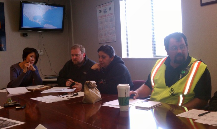
City employees discuss logistics for Saturday's Earth Day cleanup in District 6.

At home, the City Attorney’s Office and Let’s Do It SF! volunteers will be participating this Saturday in DPW’s Clean Team event to clean and green District 6. Sign up here to join us.

Standard
Gov 2.0, News, Public Participation

Third Thursdays SF with TransportationCamp

Friends of OpenSF packed into mid-Market’s Mavelous last night, kicking off discussion and networking around transit-oriented innovation, tech, good government and healthy cities. The event was Third Thursdays SF, a monthly tech and civics meetup organized by OpenSF, CityCampSF, GovFresh and Gov 2.0 Radio (my “networked government” Web radio show).

City workers, local developers and progressive activists were greeted by Frank Hebbert from OpenPlans, who opened the night with a short film by Streetfilms recapping the TransportationCamp unconference held in New York earlier this month. TransportationCamp is in SF this weekend at Public Works.

More photos of March’s Third Thursdays event here.

Standard
Gov 2.0, News, Open Data, Open Source

Chris Vein: From SF to the White House

As reported on Twitter, Gov 2.0 Radio and FedScoop on Wednesday, former SF CIO Chris Vein has decamped for Washington, DC, where he is the new deputy CTO for innovation.

Gov tech pubs have been abuzz with the news.

More at InformationWeek.

On the Code for America blog, Jennifer Pahlka discusses how Vein was instrumental in supporting Civic Commons and CfA. “I’m happy to see Chris and his commitment to change join the other innovators in the White House, all of whom have inspired our work,” Pahlka writes.

The National Association of Communications Officers and Advisors also did a nice write-up on the promotion for its longtime member: “This is an outstanding appointment,” said NATOA Executive Director Steve Traylor. “And it’s an important recognition by the Obama Administration of the importance of local government efforts in technology and broadband innovation.”

Good luck to Chris in his new role!

Standard
Gov 2.0, News, Open Data, Open Source, Public Participation

OpenSF Relaunch; ‘Third Thursdays SF’

We’re excited about a fresh new look for OpenSF, a team blog dedicated to innovation, collaboration and transparency in San Francisco government. OpenSF was originally launched by Jay Nath, director of innovation in the City’s Department of Technology, and his team members were the primary contributors. For about a year, I’ve been writing regularly for OpenSF, highlighting social media projects by the City Attorney’s Office and sharing news from the San Francisco Gov 2.0 community and from other City departments.

Today, we’re got a great new look thanks to the volunteer efforts of GovFresh founder Luke Fretwell, we’ve got an OpenSF Twitter account, and were adding new contributers from the City family. OpenSF is an informal place to share about our projects and thoughts and to dialog with San Francisco residents and the global Gov 2.0, Open Government and Open Data communities.

We’re also excited to announce a new monthly networking event for anyone interested in topics of tech and good governance. Called ‘Third Thursdays,’ the meetup is also supported by CityCampSF, Gov 2.0 Radio and GovFresh. You can join Third Thursdays on Facebook here, and find out about the latest events. Also, click here to hear Jay and I discuss OpenSF, Third Thursday and more on Gov 2.0 Radio.

Thanks for reading, and welcome to the new OpenSF!

Photo: Brett Husbands of Firmstep at Daly’s Dive (Buck Tavern), the venue for Third Thursdays SF.

Standard
Gov 2.0, News, Open Data, Public Participation

Open Gov Summit Planning in SF


I headed over to Granicus’ SoMa offices last night to join in a local planning meeting for an SF Bay Area open government summit. Eight of us discussed a local event as part of a U.S.-wide series of municipal-level summits to organize around and promote themes of transparency, participation and collaboration in government.

In the spirited discussion, organizers discussed aims for the May event, such as:

  • Telling stories of why transparency, participation and collaboration matter for local government and community;
  • Highlight best practices from local governments;
  • Create greater awareness of the open government principles;
  • Foster better inter-governmental cooperation.

Based on the discussion around this summit, I suspect that CityCampSF, a loosely organized group that put on an unconference last October, will sharpen its focus to promote informal meetups around civic innovation and organization of volunteers and stakeholders around technical solutions for improving government engagement and efficiency.

One of the goals of OpenSF is to encourage more city workers to engage around Gov 2.0 principles of working directly with volunteers and community stakeholders to create agile solutions, and to increase two-way communication through social media.

Find our more about how to get involved in planning the opengov summit in the Bay Area, or in your community, at the OpenGov Playbook wiki.

Also, learn more about Gov 2.0 and the modern definition of Open Government on this collaborative Google document.

Adriel Hampton

Standard
Gov 2.0, News, Open Data, Open Source, Public Participation

Code for America Open House

After work today, I ducked into Code for America’s open house in SoMa, joining a vibrant tech crowd including CfA founder Jennifer Pahlka, Craig Newmark, SF Environment’s Lawrence Grodeska, Tim O’Reilly and many more. CfA is a non-profit organization that pairs teams of civic hackers with host cities to match Web 2.0 solutions with community challenges.

Four teams leave Saturday for a month with their host cities of DC, Boston, Seattle and Philadelphia, and the CfA fellows took time to answer questions about their mission.

Learn more about Code for America on its site. Check out more Code for America photos here.

Adriel Hampton

Standard
Gov 2.0, News, Open Data, Open Source, Public Participation

Open Source App Links Volunteers, Heart Attack Victims

Fire Department App – PSA from Fire Department on Vimeo.

Imagine, you’re in the middle of a weekly team meeting when your iPhone vibrates. You stand up and calmly tell your coworkers, “There’s been a heart attack in the first floor gym. I’m CPR trained. I’ll be back as soon as I can.”

Similar scenarios may soon by playing out all over the country thanks to groundbreaking use of the location-aware features of modern smartphones and access to emergency dispatch information from local fire departments. In the San Francisco East Bay, it could be happening in a matter of days, as the San Ramon Valley Fire Protection District rolls out its new ‘Fire Department’ app for iPhone, which launches publicly today.

I felt the world change
A couple weeks back, I found myself in Chief Richard Price’s office with my friend Joe Hackman, eyes glistening with tears as we watched a PSA video for the application (read Joe’s thoughts on what the new app means to our SF East Bay community). In the video, a 72-year-old man collapses at the lumber store; across the parking lot, a young man in an electronics store gets an alert “CPR needed” – his phone gives him an address and map of where to go, and shares the location of the nearest automated external defibrillator. Sitting in that office, seeing an app that puts real life-saving information at the fingertips of any willing and trained volunteer, I felt the world change.

The creators of this application have moved beyond the real‐time Web to the right time Web. – Tim O’Reilly, O’Reilly Media

Chief Price and his staff first conceived of this application more than a year ago, after an incident in which they were having lunch and learned on their radios that a man was having a heart attack just steps away. Heart attack-induced brain death begins in just minutes, and fire department staff simply cannot arrive fast enough to save most people – but any army of CPR-trained volunteers can. And while they have had to be in exactly the right place to respond, the new app will dramatically extend the ability of everyday citizens to save lives.

Price told me that he has just 43 firefighters on duty during the day, but in his suburban district of 170,000 people, 10 percent have CPR training. “You can see the significance,” he said. Area residents will see the app PSA in local movie theaters beginning this weekend.

Price and his staff developed the iPhone application in partnership with the Center for Applied Informatics at Northern Kentucky University. Over the coming weeks and months, he will work with the International Association of Fire Chiefs and developers at Workday to bring the free application to Android and other mobile platforms, and to spur widescale adoption.
Map on iPhone Showing Victim's Location and Nearest AED

“The value of this application is far too important to society to not ambitiously share it with other communities around the globe,” Price said.

In the San Ramon Valley alone, community members who download the new app could help respond to as many as 100 calls a year. Across the U.S., nearly 300,000 people die each year of cardiac arrest.

“I think in the big picture, what we recognize is that of the people who have sudden cardiac arrest, less than one in three get CPR,” said heart surgeon Junaid Khan, president of the American Heart Association’s East Bay board. “Without CPR, a person really has very little chance of survival. For the first time, a smart phone application can actually help save a life.”

‘You can get there faster’
Dr. Khan and Chief Price also talked about the added benefit of creating more responders. Historically, even CPR-trained individuals sometimes balk in the face of crisis, but now self-identified volunteers within 500 yards of a heart attack in a public place will receive push notifications, increasing the likelihood of two or more responders, who can encourage one another and even take turns administering CPR.

“I think this is really a perfect marriage of technology with a government service and volunteers who want to participate,” said Kahn. “Every minute lost dramatically decreases your chance of survival. Literally every minute counts.”

I asked Kahn about the medical savings associated with early response in terms of less long-term damage. He said more data is needed for such an epidemiological study. “If you get the patient to the hospital before significant damage, the chance that they would successfully recover obviously increases. This app would let you know. You can more likely get there faster than the fire department.”

CPR in Progress

To learn about CPR and AED training in your area, visit the AHA’s website.

For more information on the new application and an electronic press kit, visit the SRFPD’s website.

To download the SRVFPD’s app now, visit ‘Fire Department’ in the iTunes store.

Chief Price will be a guest on Gov 2.0 Radio on the evening of February 6, 2011, to discuss this new technology.

– Adriel Hampton

Standard
Gov 2.0, News, Open Data, Public Participation

Civic Hackers Invade San Francisco

On the way in to Civic Center this morning, I stopped by the new SoMa offices of Code for America, a non-profit startup that deploys top web professionals in one-year fellowships building Web 2.0 applications for cities across the U.S. The fellows, recruited from around the country, are here for January before heading off for a month of hands-on research at their host cities.

Code for America is hosting an open house on Wednesday night, and also ‘Labs Fridays,’ in SF and host cities, where coders will work to resolve smaller municipal tech and operational challenges on the spot.

Very cool to have this action-oriented program in San Francisco!

Adriel Hampton

Standard